Mountain Park is in Dover, a valley town settled 300 years ago in the Appalachian Highlands of Northern New Jersey. For those unfamiliar with the area, Dover is surrounded by hills once rich in magnetite, a mineral with very high iron content. The Rockaway River runs through town, as once did the Morris Canal, which made it an ideal location to support early mining operations and industrial development.
Mountain Park History: One small mining operation in Dover was the Munson Iron Mine located on Oram Hill(?) in South Dover. The Munson Mine built two railroad tracts to carry ore down to the town, but production was small and economically insufficient. Mining operations were soon abandoned. Over many decades that followed, the Munson Mine property remained untouched as it was too steep for development. Vegetation and a wide variety of trees reclaimed the land to form a verdant forest. It was purchased by the Town of Dover under an Open Space Preservation Grant in the mid-1970s(?) and renamed Mountain Park.
Mountain Park has a peak elevation of 750 feet and rises about 100 feet above the town. It features an excellent overlook of the valley. The park entrance is on S. Morris Avenue, just north of the Christadelphian Church. The only public parking would be street parking on Woodland Avenue across the street.
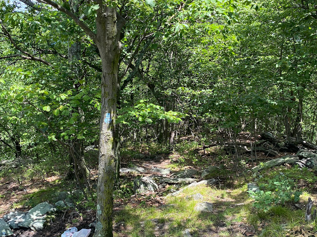
The trailhead starts in a narrow patch of woods that opens to a large lawn flanked by private houses. Don’t be concerned because almost the entire field is park property. Cross the lawn to where the White Trail begins at the edge of the woods. It is generally well-marked and maintained by volunteers (I as understand it). The ground was soft, damp, and mostly covered by fallen leaves when I hiked the trail. It is a modest and steady climb to the top of the hill under a canopy of a wide variety of trees and some ground cover near the entrance. The sound of rushing water can be heard on your right near the trailhead, but the brook is not visible.
The brook, I discovered later, is an unnamed tributary to the Rockaway River flowing from underground springs into storm drains along Warren Street and Rose Way. On an 1853 map of Randolph Township, the spring’s water flowed freely over the surface. The brook was apparently buried when the residential neighborhood was built.
Continuing up the trail, the incline becomes steeper as it nears the top. There are areas where the trail has washed out during recent rains. There are also two optical internet cables going into Victory Gardens strung haphazardly across the pathway. One is about chest high and the other near the ground. It is a foot-trip hazard, so beware.
 |
| Fiber optic cable across the trail |
 |
| View of Dover, NJ, from the overlook at Mountain Park. |
The vista at the top of Mountain Park looks to the north, with the Gunther Mill building towards the center view. The Dover rail yard is just out of sight below. The rocky outcrop provides good places to sit while enjoying this beautiful scenic view. But be careful. The spot appears to attract underage or thoughtless drinkers who leave trash, empty beer bottles, and broken glass strewn about. It is an unfortunate distraction to an otherwise peaceful spot.
Another feature of the park that visitors might miss is the broad variety of the trees that populate this forest sanctuary and the many different birds they attract. Among the trees I identified along a portion of the trail were Red Oak, various species of Maple, American Beech, Sweet Birch, Swamp Chestnut Oak, Smooth Adler, and Black Oak. I’m sure there are others. A future enhancement to Mountain Park might be a project to identify and label the many different trees along the trails for the educational benefit of school children and adults interested in learning to identify them.


Thank you for the wonderful detailed description of the trail. I have walked the trail but look forward to following in your footsteps.
ReplyDelete